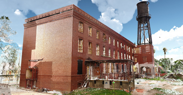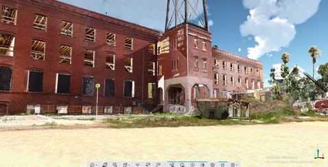
This month our scanning department had the opportunity to conduct a full 3D scan of the Perfecto Garcia Brothers Cigar Factory. The current 44,000 square foot brick building was built in 1914 with three floors and a basement that had two attachments added early in the life of the building. The first attachment in the mid 1920’s and the second attachment in the late 1930’s.

Terrestrial LiDAR, or 3D scanning, has been available for almost two decades and provides the ability to measure objects and the environment with an accuracy of a couple millimeters. 3-D scanning is a non-contact technology that uses a laser to collect measurements of the environment around the scanner to capture the exact size and shape of everything around it through millions, and even billions of points. With the millions of data points collected, the environment being scanned can then be turned into a virtual reality of the real-life version referred to as a "digital twin".
After scanning a site, the data is taken back to our office and processed by us to get a cohesive point cloud that is checked for accuracy. We then do one of two things. First we can send it out to a company to do Building Information Modeling (BIM) that can be used for building development or engineering. Second, we can send them the registered point cloud in just about any format and they can determine the next steps.


The NavVis is a mobile indoor mapping system that we utilize to increase performance and timeliness. The FARO X330 is a long range, terrestrial scanner that has considerable accuracy and efficiency. The use of both pieces of equipment combined yields highly accurate and precise measurements in all situations and environments.
Need 3D scanning services? Contact us!


